
World 🢖 North America 🢖 Mexico 🢖 Tamaulipas
Sinkholes 🢔 Caves 🢔 Geological wonders 🢔 Categories of wonders
Wonder
La Pilita sinkhole, Sistema Zacaton
 In short
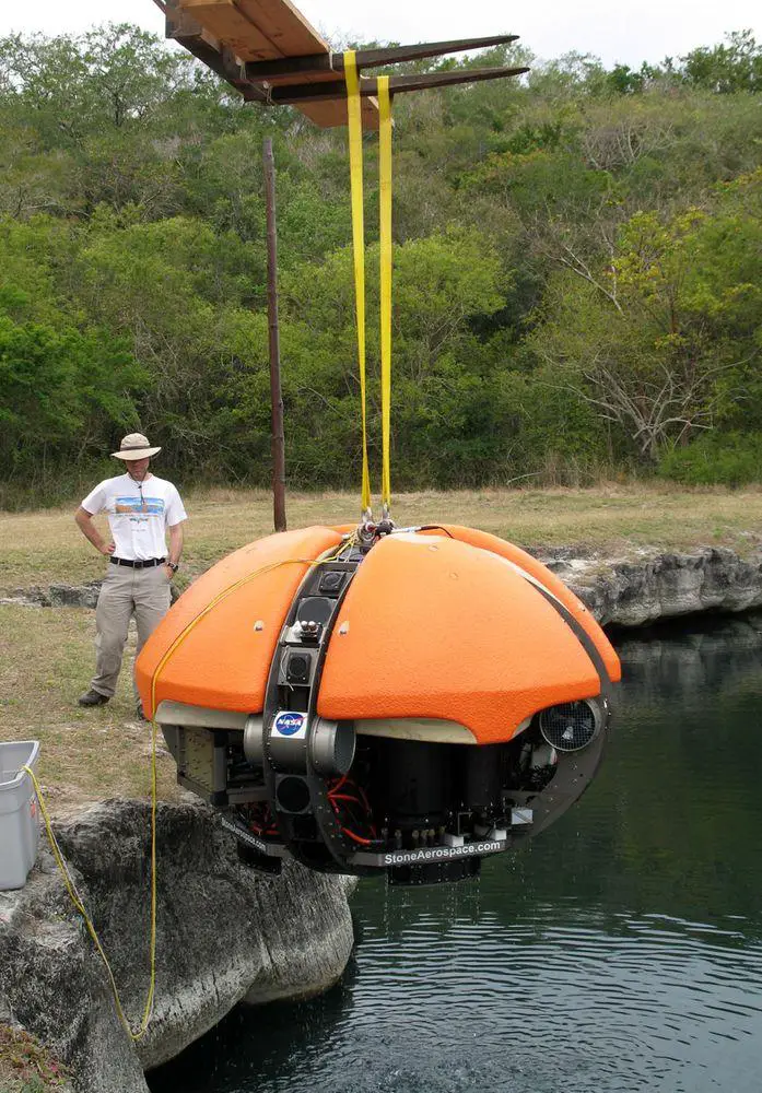
This sinkhole is one of the most interesting features in the unique Sistema Zacatón karst field.
 40.8%
40.8%
GPS coordinates
Location, address
Alternate names
Depth
Map of the site
If you see this after your page is loaded completely, leafletJS files are missing.
 In detail
La Pilita sinkhole seems to be comparatively small – diameter of waterbody at the surface is just some 20 – 35 m. But this deep blue pool with slightly acidic water is more than 120 meters deep!
Sinkhole in process of closing
At greater depth La Pilita becomes wider – at the depth of 45 m, it is 120 m wide in the north-south direction and 90 m wide in the east-west direction.
It has not always been that – earlier La Pilita has been wide also at the surface level. This is testified by a wide travertine rim around the sinkhole. This plain travertine is covered with a pleasant meadow.
Walls below the water level resemble the formations usually formed by hot mineralized springs. These walls are covered with bright red, pink, and green microbial mats, often hanging down like stalactites.
Water in La Pilita is more than 31° C warm (the warmest of five central cenotes), it contains little dissolved oxygen. There is felt the smell of rotten eggs around this sinkhole.
References
- Marcus Gary, Sistema Zacatón, research homepage. Accessed in the 23rd June 2010
Linked articles
Wonders of Mexico
Few countries in the world can offer such an array of unique and astounding attractions as Mexico.
The area of this country was the cradle of several highly developed indigenous civilizations and some regions in the country are dotted with remnants of ancient cities with temples, palaces, and pyramids.
Lakes and streams
There are many factors that can make lakes, sea bays, or rivers unusual. Some lakes have unusual chemical properties and even do not contain water at all – such as lava lakes. Others may have unusual animals living in them or… legends about such animals.
Sinkholes
This category includes outstanding sinkholes – large natural depressions or holes, which for most the part represent collapsed caves.
Recommended books
Hypogene Karst Regions and Caves of the World

This book illustrates the diversity of hypogene speleogenetic processes and void-conduit patterns depending on variations of the geological environments by presenting regional and cave-specific case studies. The cases include both well-known and newly recognized hypogene karst regions and caves of the world. They all focus on geological, hydrogeological, geodynamical, and evolutionary contexts of hypogene speleogenesis.
Encyclopedia of Caves and Karst Science

The Encyclopedia of Caves and Karst Science contains 350 alphabetically arranged entries. The topics include cave and karst geoscience, cave archaeology and human use of caves, art in caves, hydrology and groundwater, cave and karst history, and conservation and management. The Encyclopedia is extensively illustrated with photographs, maps, diagrams, and tables, and has thematic content lists and a comprehensive index to facilitate searching and browsing.