
Bridges and overpasses 🢔 Transport infrastructure 🢔 Architectural wonders 🢔 Categories of wonders
Wonder
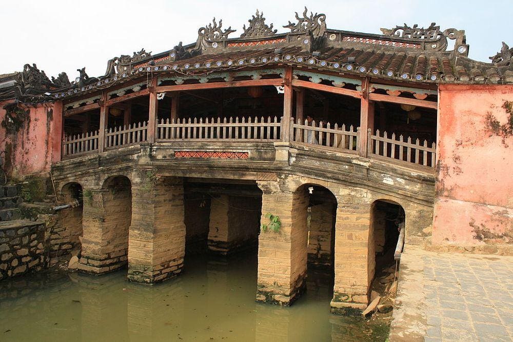
Chua cau (Japanese Bridge)
 In short
Historical covered bridge with a Buddhist temple at one end of the bridge. Bridge was constructed by a local Japanese community in 1593.
 41.3%
41.3%
GPS coordinates
15.8772 N 108.3261 E
Bridges and overpasses
Map of the site
Travelers' Map is loading...
If you see this after your page is loaded completely, leafletJS files are missing.
If you see this after your page is loaded completely, leafletJS files are missing.