
World 🢖 North America 🢖 Mexico 🢖 Nayarit
Cities and towns 🢔 Settlements 🢔 Architectural wonders 🢔 Categories of wonders
Wonder
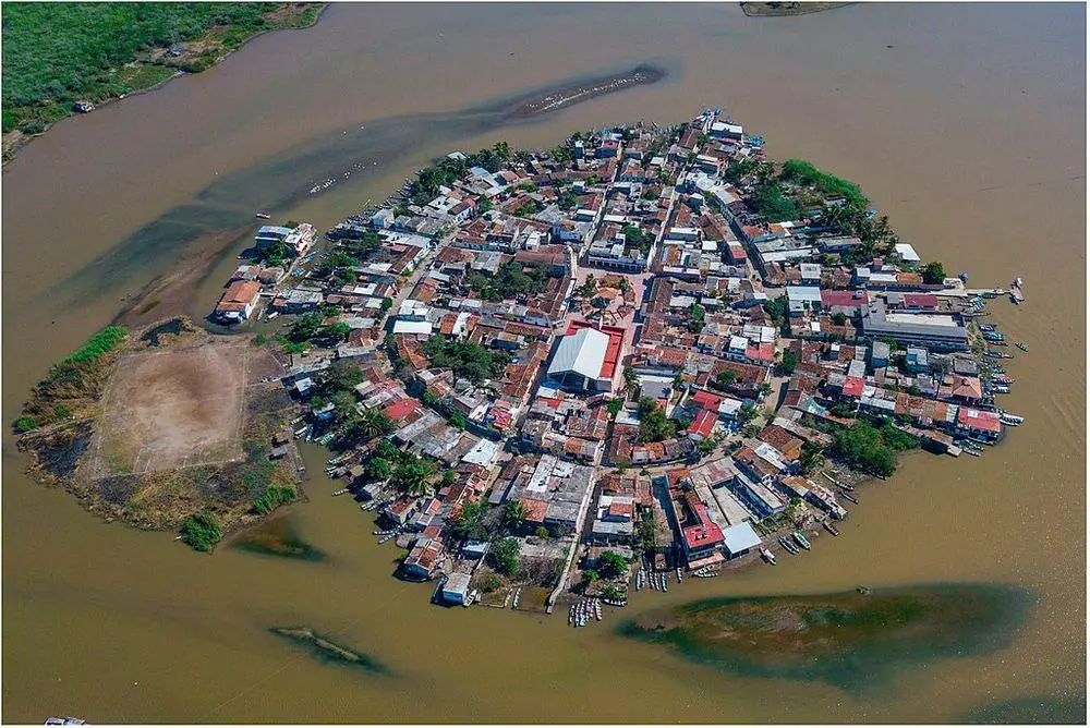
Mexcaltitán
 In short
Unique monument of urban planning – man-made island city in shallow lagoon with central, radial planning, resembling a giant wheel in plan. At high water the streets in the town turn into channels.
 46.5%
46.5%
GPS coordinates
21.9058 N 105.4752 W
Location, address
North America, Mexico, Nayarit, Santiago Ixcuintla Municipality, Mexcaltitán de Uribe
Map of the site
Travelers' Map is loading...
If you see this after your page is loaded completely, leafletJS files are missing.
If you see this after your page is loaded completely, leafletJS files are missing.