
Geothermal fields 🢔 Geothermal features 🢔 Geological wonders 🢔 Categories of wonders
Wonder
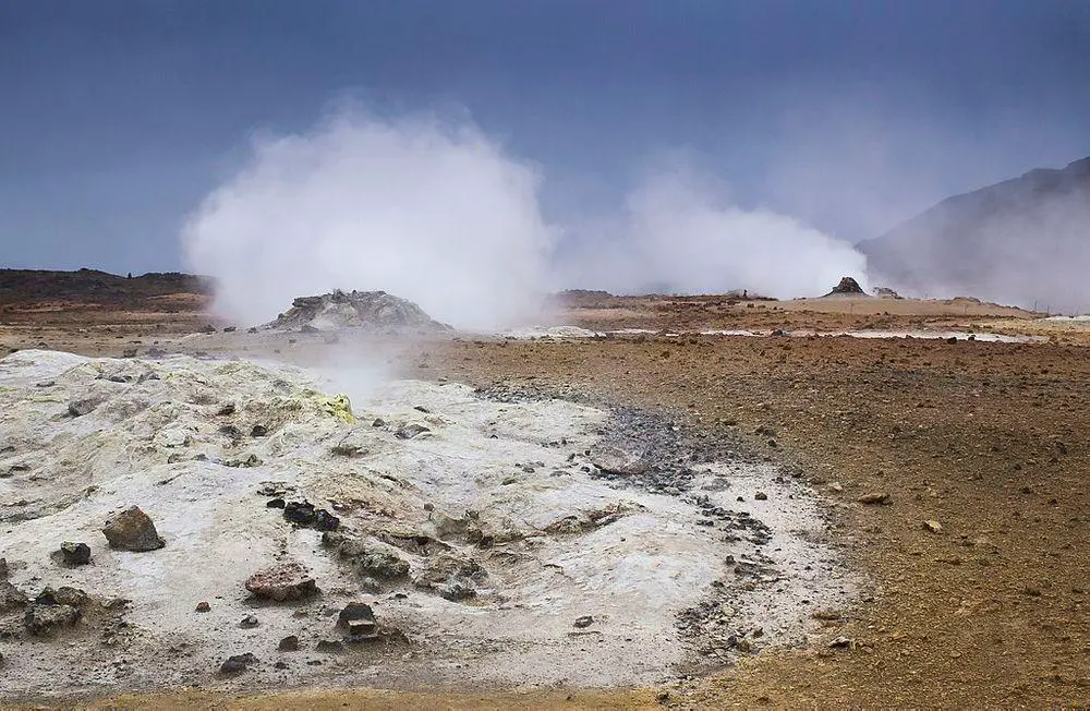
Námafjall Geothermal Area
 In short
Large, colorful geothermal field with boiling mud pots, solfataras, sulfur deposits. Once important mine of sulfur for the medieval Europe.
 43.8%
43.8%
GPS coordinates
65.6410 N 16.8092 W
Location, address
Geothermal fields, Fumaroles, Mines and pits
Alternate names
Hverir Geothermal Field, Námafjell
Map of the site
Travelers' Map is loading...
If you see this after your page is loaded completely, leafletJS files are missing.
If you see this after your page is loaded completely, leafletJS files are missing.