
World 🢖 North America 🢖 United States 🢖 Alaska
Fumaroles 🢔 Geothermal features 🢔 Geological wonders 🢔 Categories of wonders
Wonder
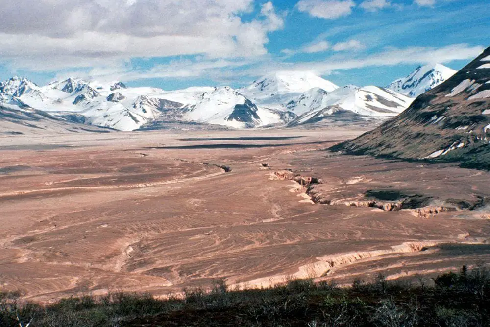
Valley of Ten Thousand Smokes
 In short
Valley which is filled with volcanic ash from an eruption in 1912. The layer of ashes is up to 210 m deep. After the eruption there formed thousands of fumaroles from this ashfield, most are extinct by now. Valley of Ten Thousand Smokes now is crisscrossed with deep river canyons.
 39.8%
39.8%
GPS coordinates
58.36751 N 155.349402 W
Location, address
Map of the site
Travelers' Map is loading...
If you see this after your page is loaded completely, leafletJS files are missing.
If you see this after your page is loaded completely, leafletJS files are missing.