
Wondermondo 🢖 World 🢖 Wonders of Australia and Oceania 🢖 Wonders of Micronesia 🢖 Wonders of the Marshall Islands
Territory
Wonders of the Marshall Islands
 Highlights
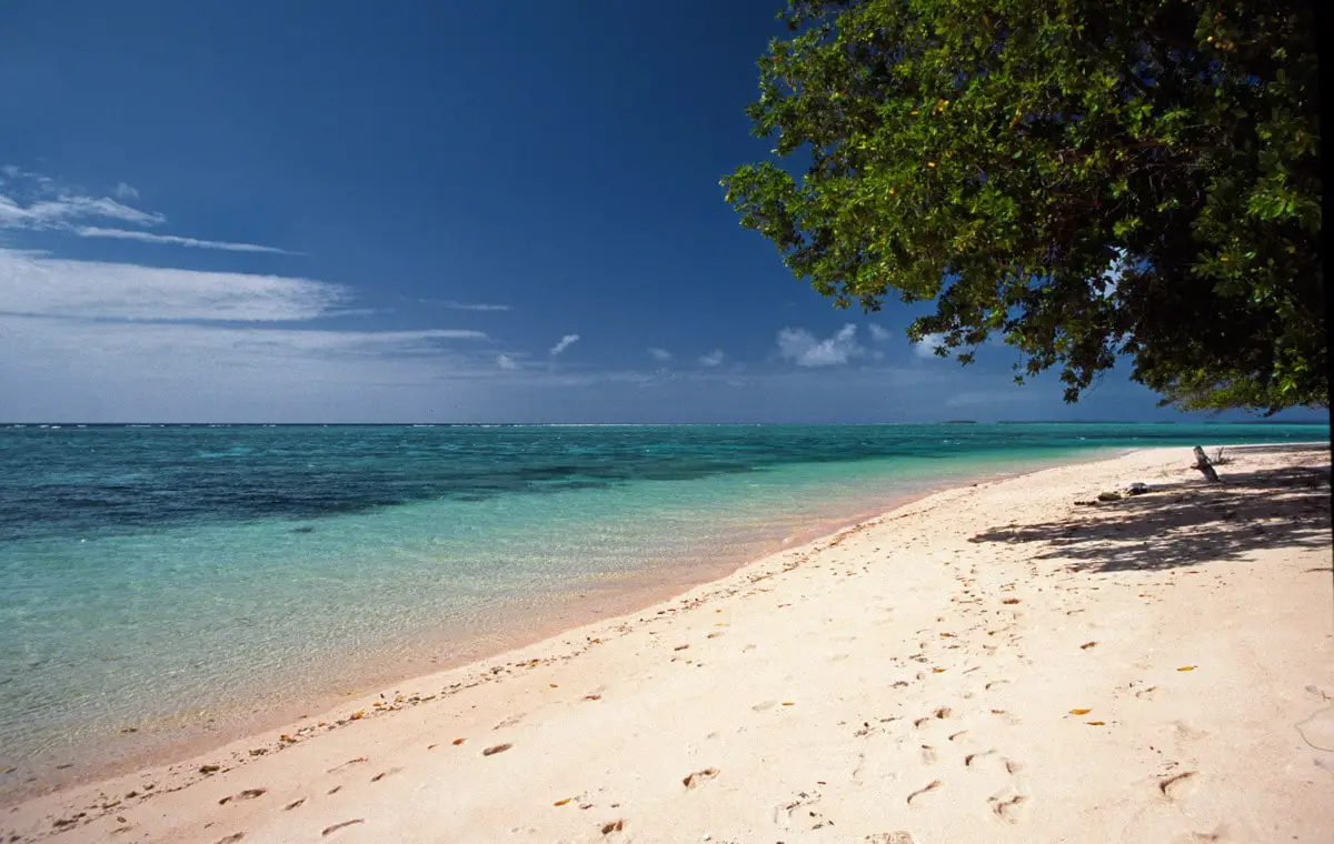
The Marshall Islands is a large group of coral atolls and scattered islands.
These remote Pacific islands have experienced terrible nuclear bombardments that have evaporated some islands and left terrible scars in these coral atolls. And, nevertheless, the nature of many islands is pristine and peculiar.
Map with the described wonders
Please add some markers to your posts before using this shortcode.
 Top 7 wonders of the Marshall Islands
Geological wonders of the Marshall Islands
Bokak Atoll lagoon
Bokak Atoll (uninhabited)
The lagoon of this atoll is 0.9 m higher than the surrounding sea. The wind brings in new seawater and the water pours out of the lagoon through a narrow channel. An unusual feature of this remote, pristine atoll is a 10 – 15 cm high, massive rim formed by algae and enclosing the shores of the coral patches in the lagoon.
Likiep Atoll
Likiep Atoll
Here is located the highest point in the Marshall Islands, located 11 m above sea level. It is amazing that a country with such a high number of islands is devoid of any hills.
Archaeological wonders
Laura settlement and graveyard
Majuro Atoll
One of the few excavated ancient settlements in Marshall Islands. The archaeological heritage in Marshall Islands is rather scarce although the islands are inhabited for some 2,000 years.
Wonders of newer times
Bikini Lagoon
Bikini Atoll (uninhabited)
Unusual, eerie place. This lagoon was used as a ship graveyard after World War II and then – as a test location for many tests of nuclear bombs. Now the many sunken ships in the lagoon are radioactive but the undisturbed lagoon is full of life and very interesting for divers.
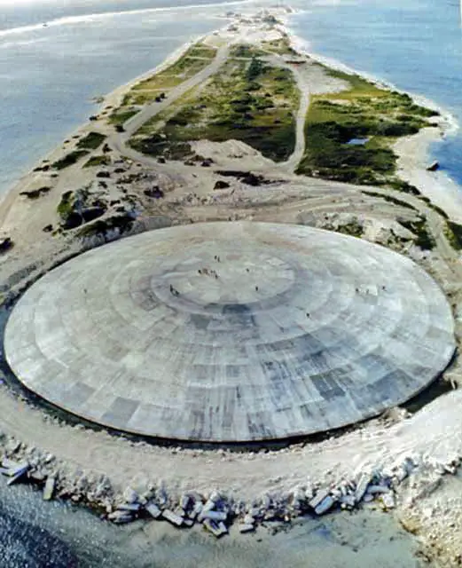
Runit blast crater
Enewetak Atoll
A blast crater formed during the nuclear tests, filled with the contaminated radioactive soil from the island and covered with concrete, forming a 7.6 m tall spherical mound.
Ivy Mike test site
Enewetak Atoll
A site where took place the first successful test of a hydrogen bomb in 1952. This giant blast evaporated Elugelam Island, creating a crater with a 1.9 km diameter. Another nuclear bomb was detonated in this crater in 1956.
Bravo crater
Bikini Atoll (uninhabited)
The 2 km wide and 75 m deep crater was created by the blast of the Castle Bravo hydrogen bomb in 1954. This 15 MT blast created significant radioactive contamination. In this same place, more nuclear tests have taken place.
 Recommended books
Micronesia: The Marshall Islands: Travel Adventures

The Marshall Islands, named after a British sea captain who explored the group in 1788, are scattered like flung necklaces over about 750,000 square miles of the Pacific Ocean. Positioned 2,200 miles southwest of Hawaii, they occupy an area between four and 20 degrees north of the equator.
Surviving Paradise: One Year On A Disappearing Island

Just one month after his 21st birthday, Peter Rudiak-Gould moved to Ujae, a remote atoll in the Marshall Islands located 70 miles from the nearest telephone, car, store, or tourist, and 2,000 miles from the closest continent. He spent the next year there, living among its 450 inhabitants and teaching English to its schoolchildren.