
World 🢖 Asia 🢖 India 🢖 Maharashtra
Fortresses and forts 🢔 Fortifications 🢔 Architectural wonders 🢔 Categories of wonders
Wonder
Gorakhgad hill fort
 In short
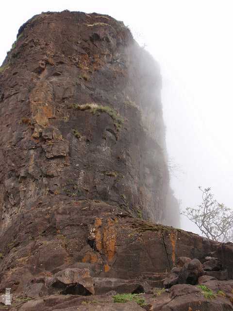
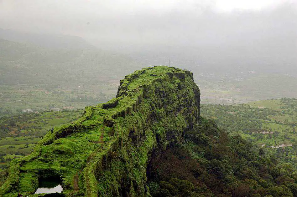
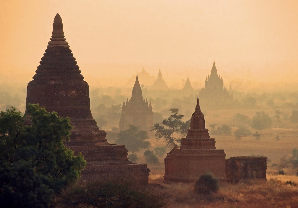
Small fort on the top of hill, well protected by steep cliffs, reaching the height of 655 m above the sea level. Named after Saint Goraknath.
 41.8%
41.8%
GPS coordinates
Location, address
Alternate writings
Age
Map of the site
If you see this after your page is loaded completely, leafletJS files are missing.
 In detail
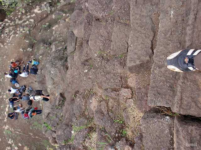
Medieval fortification, a hill with nearly vertical sides and remnants of defensive structures – although due to steep cliffs not many additional structures were needed. Contains also two Hindu rock-cut cave temples – Gorakhgad Caves. Rock-cut steps lead to the summit, at one place going through the rock-cut gate. The rock contains several water tanks cut in the cliff. Rock-cut steps closer to the summit are especially risky and one has to traverse the cliff that hangs over an abyss. On the summit, there is located the small temple of Goraknath with a small statue of Nandi in front and linga inside the temple.
During the monsoon period the steep hill offers exotic jungle-covered mountain scenery with waterfalls sliding down along the steep walls of an ancient fort.
Possibly the Alka-Palka fortress mentioned in connection with the capture of nearby Ankai-Tankai hill fort by the general of Mughal Shah Jahan.
Fort was a vital link between the important Fort Durg to the northeast and Fort Siddhagad to the southwest. During the times of Shivaji Maharaja (great Maratha king, 1642 – 1680) it was used to patrol the nearby area.
Although there are not known any significant historical events connected with this fort, nowadays it is a beloved destination for trekkers.
References
- Ankai-Tankai-Gorakshanath, Picasa, photo collection by sameer, accessed on 5 May 2010.
Linked articles
Wonders of India
India is the seventh-largest country in the world by area, and, naturally, such a large area contains a huge amount of exciting attractions…
Wondermondo considers that India is the second richest center of architectural heritage in the world after Europe and maybe no single country in the world can match it in this respect.
Wonders of Maharashtra
Maharashtra is a truly splendid state. It has everything – enormous metropolises and countless waterfalls in mountains, urban decay, and architectural splendor, remnants of millennia-old Harappan towns, and modern, very expensive architecture.
Wonders of Asia
Any other continent (and part of the world) seems small if compared to Asia. This refers also to natural and man-made heritage: in Asia are not just thousands of great landmarks, there are found landmarks created by thousands of diverse cultures from ancient Phoenicians to the mysterious small people in the Philippines and eastern islands of Indonesia.
Recommended books
Indian Castles 1206–1526: The Rise and Fall of the Delhi Sultanate

From the beginning of the 11th century onwards, the constant state of war amongst the various Indian kingdoms left them open to outside attack, and Muslim Turkic tribesmen began to pour over the northwest border from modern-day Afghanistan. These raiders consolidated their successes and by 1206 a Muslim state, the Sultanate of Delhi, had been founded, which then extended its direct rule or influence over most of the subcontinent.