
World 🢖 Asia 🢖 India 🢖 Meghalaya
Places with meteorological phenomena 🢔 Geological wonders 🢔 Categories of wonders
Wonder
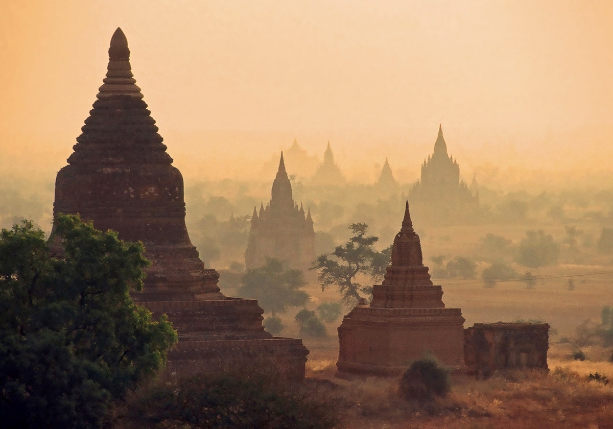
Cherrapunji (Sohra)
 In short
Nearly all schoolbooks around the world mention a remote village in India – Cherrapunji. For many years this was considered to be the wettest place in the world. Now the title goes to nearby Mawsynram and there are other serious contenders. Whatever, Cherrapunji is an extraordinary and beautiful place.
 45.4%
45.4%
GPS coordinates
Location, address
Map of the site
If you see this after your page is loaded completely, leafletJS files are missing.
 In detail
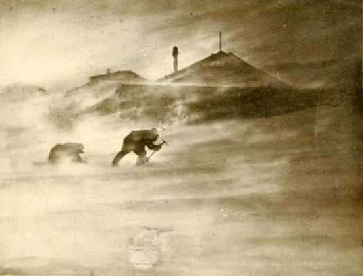
Monsoon rains
Cherrapunji (the old and lately returned name – Sohra) is a town located on a high plateau in Khasi Hills, rising 600 m above surrounding valleys. This is a beautiful, fairy-tale landscape, some 1,200 – 1,400 m above sea level.
Contrary to the plains of Bangladesh further south, here almost never gets hot: for the most part, there is a pleasant 24°C temperature. Only the dry winters might become unpleasantly cold – sometimes it is almost freezing.
As the spring ends, by the third week of May the weather in Khasi Hills becomes very humid. There has started monsoon – nearly constant wind blowing from Bengal Bay and Bangladesh to the dry Tibetan plateau which at this time of the year has low atmospheric pressure.
Air masses gather lots of humidity from the baking hot swamps of Bangladesh and the sea in Bengal Bay. The wind blows without obstacles over the extremely flat plains of Bangladesh, which is 400 km from the sea rise only 10 – 30 m above the sea level.
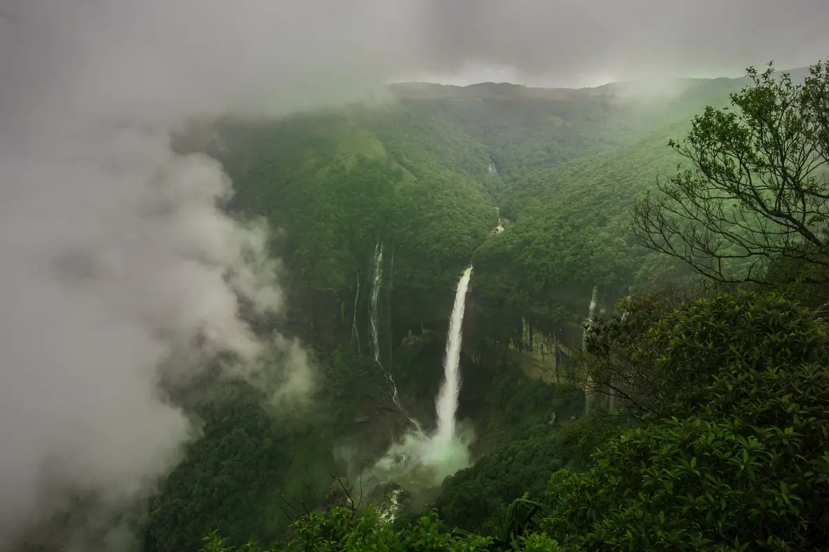
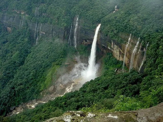
But, as the humid, heated air masses reach Khasi Hills, over an 8 – 9-kilometer distance they reach 1,200 – 1,400 m tall mountains. The abrupt change in conditions leads to extremely heavy downpours of rain, which are especially powerful on the southern slopes of Khasi Hills.
Another reason for powerful rain is the proximity of Cherrapunji to the line of the discontinuity between the dry eastern and northern winds and moist southern and western winds.
Powerful rains and high cliffs lead to another spectacular phenomenon – tall waterfalls. Khasi Hills contains several of the most impressive waterfalls in India. Especially great are the approximately 335 m tall Nohkalikai Falls near Cherrapunji.
World records
Different sources give a different number for average annual rainfall in Cherrapunji – from 10,816 mm to 12,063 mm of rain per year.
More than 80% of rains in Cherrapunji fall in summer: from May to September. The remaining part of the year gets a lot less rain and there might be even droughts in winter when local people (living in one of the wettest places in the world!) have a hard time getting any water. It has happened though that daily rains have lasted here for two years.
As Brits moved into this beautiful land, they noticed the extreme rainfall. The meteorological observatory was established in 1902 in a convenient location – Cherrapunji town. Before 1902 there were rain gauges installed in several locations of Cherrapunji and thus climatic records are available since 1871 – a luxury that is rare even in many parts of Europe.
Here have been measured several world records of rainfall:
- Yearly rainfall – 24,555 mm in 1974.
- Rainfall in one month – 9,300 mm in July 1861.
- Some believe that Cherapunji holds the record for rainfall in one day – 1,563 mm on June 15-16, 1995, measured in 8:30 one day – 8:30 next day. Three times more than it rains in London PER YEAR! In European or American cities even 5 minutes of such rain would lead to flash floods and make headlines in newspapers, but here it continued for a whole day – for 1,440 minutes! But this record has been beaten elsewhere – at Cilaos, Reunion Island, wherein 15 – 16 March 1952 was registered 1,870 mm rainfall!
Most rain in Cherrapunji falls in the early morning hours, as the moist air rises from valleys, where it has been trapped in the night.
Lately though it has become clear that nearby there are locations that get even more rain. Just 15 km to the west there is Mawsynram village which over the last years become established as one of the rainfall champions in the world. The average annual rainfall here is 11,873 mm. Most likely also other records have been registered in Cherrapunji just because there is a meteorological observatory – other locations nearby may have more rain.
There is another – more worrying tendency. It seems that the climate in Cherrapunji is changing due to deforestation, which leads to severe droughts in winter. Population in the town has grown from 7 thousand in 1960 to more than 100 thousand in the 2000s in the Cherrapunji area (the town itself has more than 10,000 inhabitants).
It is well possible that some other remote locations of the world get even more rain than Khasi Hills – just there are no meteorological observatories. Such contenders might be the upper reaches of the Nakanaï Mountains in New Britain, Papua New Guinea, and many other remote tropical regions. Lloro town in Colombia gets 13,300 mm of rain per year – here the rain is spread throughout the year – thus it certainly beats both Cherrapunji and Mawsynram in this respect, but the intensity of rainfall is less impressive.
Land of Khasi People
The beautiful Khasi Hills are inhabited by the proud and distinctive Khasi people (around Cherrapunji – Khynriam sub-tribe). Khasi belongs to Mongoloid race, to the Mon-Khmer group, and are more closely related to people living in Cambodia, Laos, and Vietnam than to most other people in India.
Their language – Khasi – is the most northern of Austro-Asiatic languages.
Khasi have interesting traditions. One of them is the recent tradition of erecting megaliths – East Khasi Hills contain numerous megaliths (Khasi monoliths). Monoliths, table stones, and cromlechs were erected to commemorate important events and deceased people.
Khasi properties are inherited from the mother to the youngest daughter. In comparison with other regions in India, women here have comparative freedom, they definitely cannot be forced into an unwanted marriage and they also own the children.
Khasi have been subjugated to other powers and have long fought against this. British Empire took over their land in the 1820s – 1830is and renamed the ancient Sohra village to Cherrapunji, building a new town to the south of the old village.
Brits declared Sohra as the capital of Assam in 1832 but as the weather was unbearable, the capital was relocated to the north, to Shillong in 1866 – 1874.
Life under the rain
Extreme rains in Khasi Hills have created an impressive and biologically very diverse landscape. The soil on the summits of plateaus is very poor due to extreme rains – everything is washed away. Thus, as a result on the wettest plateau of the world, there are not too many plants and the existing ones are used to dry conditions.
This is compensated with rich, fertile land down in valleys. Here grow the most biodiverse forest of India: Meghalaya subtropical forest filled with endemic plants including hundreds of beautiful orchids (265 species recorded in Khasi Hills). Here live tigers, elephants, bears, and other large mammals.
References
- O.N.Dhar, S.M.T.Farooqui, A Study of Rainfalls Recorded at the Cherrapunji Observatory, Hydrological Sciences – Bulletin – des Sciences Hydrologiques, XVIII, 4 12/1973. Accessed on 28 August 2010
- Preet Werma Lal, Wettest Spot on Earth, IndiaCurrents. Accessed on 28 August 2010
Cherrapunji (Sohra) is included in the following list:
Linked articles
Wonders of India
India is the seventh-largest country in the world by area, and, naturally, such a large area contains a huge amount of exciting attractions…
Wondermondo considers that India is the second richest center of architectural heritage in the world after Europe and maybe no single country in the world can match it in this respect.
Meteorological phenomena
Unusual weather conditions can happen in any place in the world. But there are locations where unusual meteorological phenomena are observed frequently – even every day.
Wonders of Asia
Any other continent (and part of the world) seems small if compared to Asia. This refers also to natural and man-made heritage: in Asia are not just thousands of great landmarks, there are found landmarks created by thousands of diverse cultures from ancient Phoenicians to the mysterious small people in the Philippines and eastern islands of Indonesia.
Recommended books
Under A Cloud: Life In Cherrapunji, The Wettest Place On Earth

It is rain that has made Cherrapunji a globally renowned village-and so Binoo K. John undertakes a tumultuous journey to unravel the mystery of the geographical quirk that brings to Cherra and the nearby village of Mawsynram as much rain in three months as the rest of India gets in a whole year. But Cherrapunji, finds Binoo, has much more to offer to the visitor: it is a land of great beauty and warmth, peopled by a cast of characters ranging from truculent bureaucrats and eccentric visionaries to friendly entrepreneurs and drivers fond of drink.
