
World 🢖 North America 🢖 United States 🢖 Oregon
Waterfalls 🢔 Geological wonders 🢔 Categories of wonders
Wonder
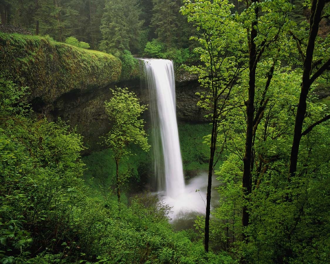
Multnomah Falls
 In short
There are numerous waterfalls in Oregon but one stands out – the gorgeous Multnomah Falls.
 46.4%
46.4%
GPS coordinates
Location, address
Total height
Drops
Highest drop
Width
Average annual flow
Stream
Map of the site
If you see this after your page is loaded completely, leafletJS files are missing.
 In detail
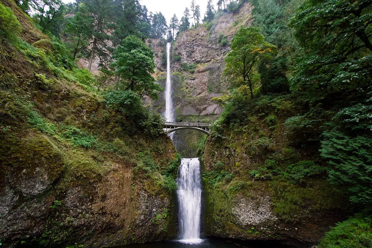
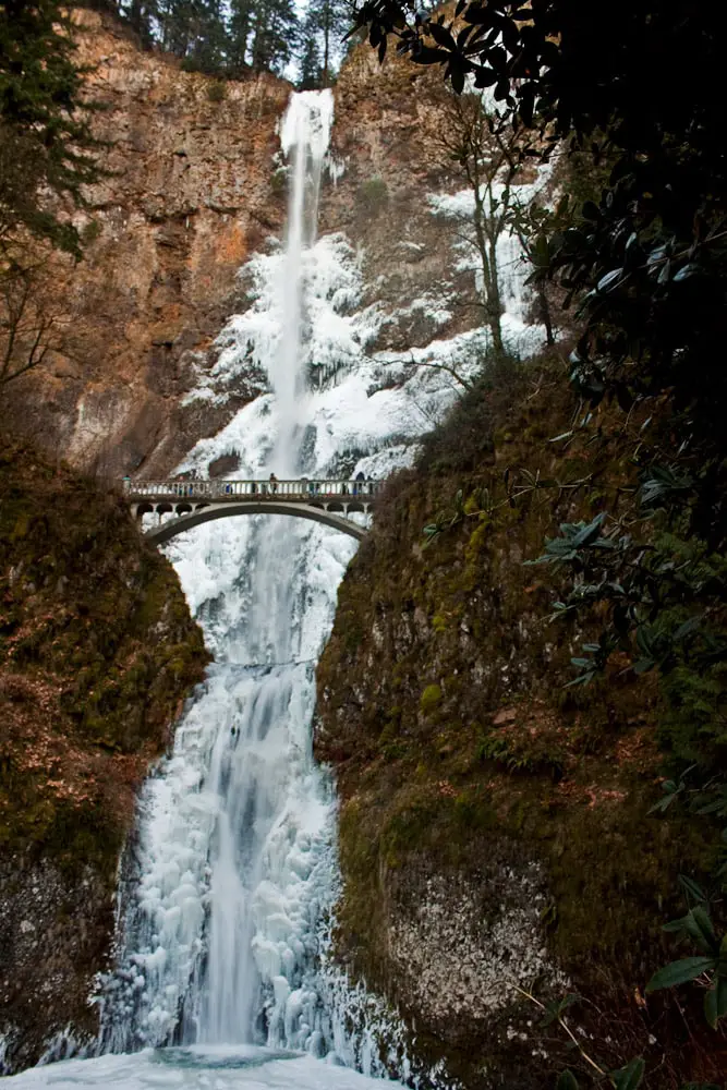
This waterfall is very tall – the tallest cascade falls uninterrupted for 165 m but several more factors make this waterfall special: such as the scenic pedestrian bridge between two drops of the falls and the easy accessibility from the highway.
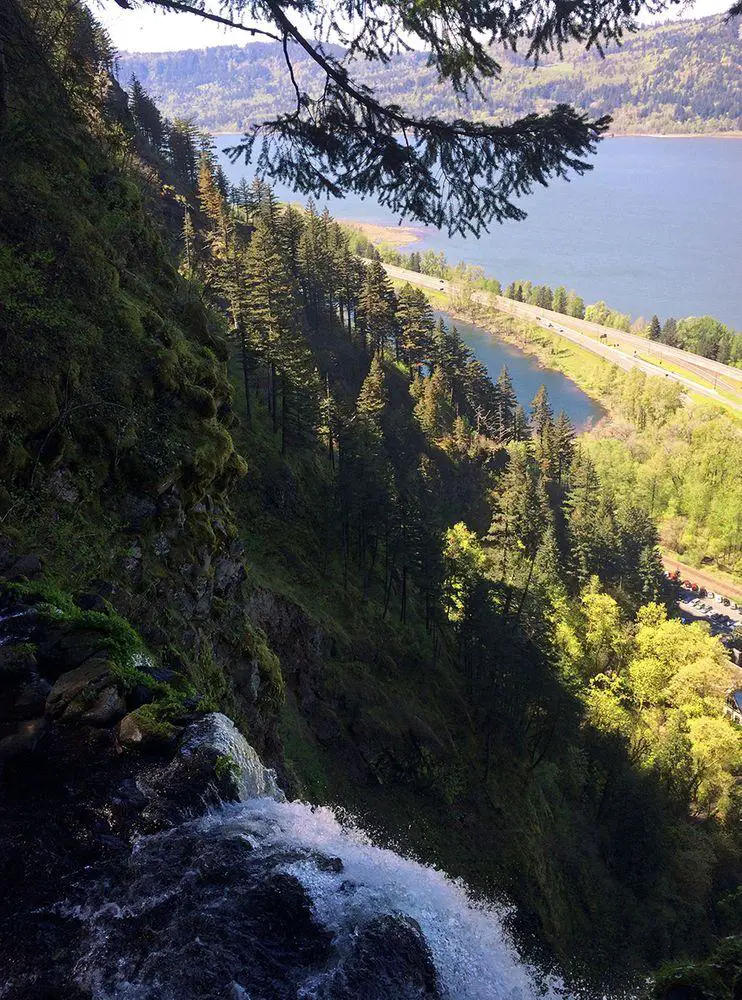
Columbia River Gorge
The Cascade Range is crossed only by three larger rivers and the largest is the mighty Columbia River. As the mountains gradually rose over the last 17 – 12 million years, the river cut a spectacular gorge through the mountains. This gorge is some 130 km long and up to 1,200 m deep.
Thanks to a high amount of precipitation here have formed numerous smaller and larger streams, which are running towards the Columbia River. When these streams reach the gorge, often spectacular waterfalls are formed. There are more than 90 perennial waterfalls known on the southern, Oregon side of the gorge.
In 1913 – 1922 along the Oregon side was built scenic highway – the first such planned tourist route in United States. Some decades later next to it was built Interstate 84.
The waterfall
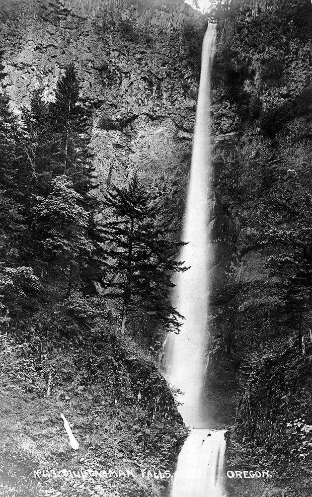
Waterfall has been known to local people since prehistoric times. People of European descent most likely learned about these falls around 1805, when the Lewis and Clark Expedition reached this area. The name “Multnomah” originates from the Chinook word which denotes the lower reaches of a river, here – Columbia River. First, this word was used to name the Multnomah County and then, around 1860 – also to name the most prominent local waterfall.
Multnomah Falls are falling over basalt rock which was exposed by one of the gargantuan lake outbursts (Mussoula Floods) which took place here during the Ice Age. Waterfalls are fed by spring in the nearby Larch Mountain. This spring is an abundant source of water throughout the year. Often the stream is supplemented by rainwater and melting snow.
Waterfall has three main drops. The upper one (some 3 m tall) is nicknamed – Little Multnomah and often has not been included in the full height of the falls. Soon after this drop comes the tallest (165 m) drop. As it hits the ground, follows a short run, and then the Multnomah Creek makes the final, nearly vertical 21 m tall drop which ends in a plunge pool.
In 1914 between the two tallest drops of the waterfall was built 14 meters long footbridge. It was financed by lumber businessman Simon Benson and is called Benson Footbridge. This gracious structure has become an integral part of the breathtaking view of the waterfall, the bridge accentuates the giant size of falls.
Benson and other influential local people rightly considered that the beautiful landscape of Columbia River Gorge has good tourism potential. It seems that Multnomah Falls in a way was a key point in their activities – here started the planning of the first scenic road in the United States, here was built also modern (for its time) hotel – Multnomah Falls Lodge. Around the falls was developed a network of footpaths.
Nowadays Multnomah Falls and their surroundings are justly popular hiking area and one of the symbols of the natural beauty of Pacific North-West.
References
- Multnomah Falls. World Waterfall Database. Accessed on April 8, 2017.
Linked articles
Wonders of Oregon
The most impressive wonders in Oregon are canyons and gorges, waterfalls, giant trees, and coastal formations.
Wonders of the United States
The United States of America is one of the largest countries in the world and offers a wide array of diverse attractions: many are unsurpassed in the world. Highlights of the United States are cliffs, canyons, and rock formations, several impressive downtowns of cities with numerous skyscrapers as well as a rich array of geothermal features, and the giant forest of California.
Waterfalls
Some of the most fascinating and awe-inspiring natural monuments are waterfalls or locations where a river abruptly changes its elevation.
Recommended books
Day Hikes in the Columbia River Gorge

Designed specifically to cover in 60 hikes nearly the entire eighty-five-mile Columbia River Gorge corridor, this is the only guidebook for the Gorge with color photographs and color topographic maps. Almost every waterfall, including secret ones, and nearly every overlook point, summit, and loop hike within the Gorge is covered in great detail with specific mileage and compass directions.
Waterfall Lover’s Guide Pacific Northwest

Let mapmaker and waterfall junkie Greg Plumb be your guide to a perfectly formed punchbowl falls, a cataract viewed from a swinging bridge, or a horsetail waterfall visible right from the road. This exhaustive guide helps you visit the best of the Pacific Northwest’s waterfalls, with each waterfall keyed for accessibility by car, on foot, or by canoe or raft and rated for magnitude and aesthetic value.