
World 🢖 Europe 🢖 France 🢖 Languedoc – Roussillon
Waterfalls 🢔 Geological wonders 🢔 Categories of wonders
Wonder
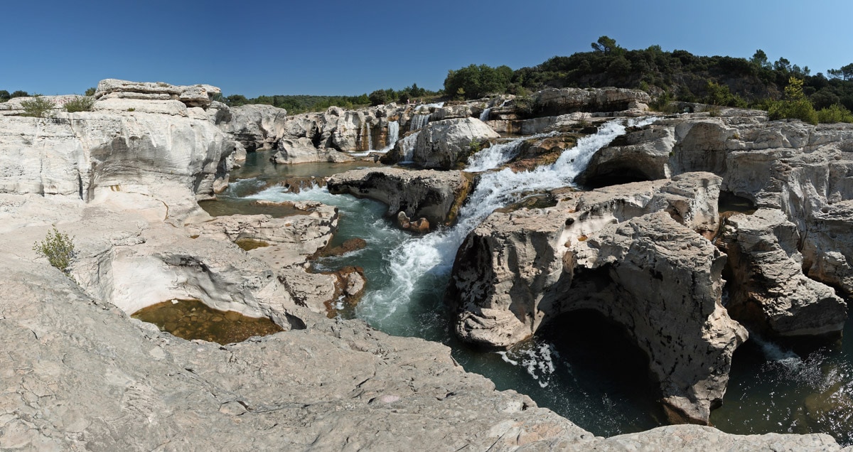
Sautadet Falls
 In short
Sautadet Falls belong to comparatively little known natural wonders of France. This is an unusual landmark characterised by a rugged beauty.
 37.5%
37.5%
GPS coordinates
Location, address
Name in French, alternate names
Height
Width
Map of the site
If you see this after your page is loaded completely, leafletJS files are missing.
 In detail
After leaving the dramatic Ardèche Gorges Cèze river enters the vast plains in Rhone valley. But here awaits the last obstacle – an enormous block of limestone formed some 5 million years ago.
The power of the stream has gnawed a passage through this stone – a 470 m long section of waterfalls, rapids, narrow ravines, hollows, and sharp stone blades.
Interesting features are up to 10 m deep kettles, hollowed by turning stones (Marmites géantes). These cylindric hollows may have a diameter of several meters.
This natural monument is quite dangerous. An inattentive visitor may fall on the sharp limestone blades or in a basin of raving water.
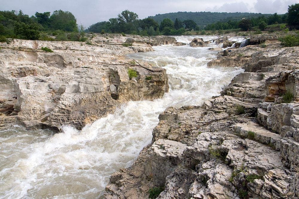
In summer the weather here might be hot and dry, but in autumn the water level rises turning the labyrinth of gullies and waterfalls into a single roaring rapid. Very frequently here blows a cold, sharp wind – mistral. It is considered that the wind also has been actively shaping the cliff formations.
In 1881 above the falls was built a weir – it allowed to operate a flour mill until 1900. Around the falls has been made also a diversion channel – Béal.
This waterfall and the harsh landscape around it is protected since 1993.
Linked articles
Wonders of France
France is home to many of the best-known landmarks in the world. This country is literally crammed with thousands and thousands of the most diverse attractions.
Waterfalls
Some of the most fascinating and awe-inspiring natural monuments are waterfalls or locations where a river abruptly changes its elevation.

Wonders of Europe
The heritage of Europe is diverse and endlessly interesting. Incomparably rich is the wealth of European historical architecture, but this part of the world has exciting natural heritage and archaeological heritage as well.
Recommended books
Wild Swimming France

Daniel Start returns with a dazzling new travel guidebook to France, for families and adventurers alike. Dip into the emerald-green plunge pools of Provence and swim beneath the great chateaux of the Loire and Dordogne. Discover the unspoiled crater lakes of the Massif Central or relax in secluded hot springs in the woodlands of the Pyrenees.
The Making of Europe: A geological history

The continent of Europe, as a recognizable geographic entity, attained roughly its present shape around 20 million years ago. Even since then, the European coastline has undergone significant changes, due mainly to sea-level movements, to form the outline of the continent that we are familiar with from maps and the photographs of Europe from space that we view today.