
Waterfalls 🢔 Geological wonders 🢔 Categories of wonders
Wonder
Blue Nile Falls – Tis Abay
 In short
Ethiopia lost a lot in the day when a hydroelectric station took away a major part of the water of the Blue Nile… and the beauty of Tis Abay. Sure, power is needed but it is always sad to see that beauty is lost.
 46.3%
46.3%
GPS coordinates
Location, address
Writing in Geʽez
Meaning of name in Amharic
Alternate names
Total height
Drops
Width
Stream
Map of the site
If you see this after your page is loaded completely, leafletJS files are missing.
 In detail
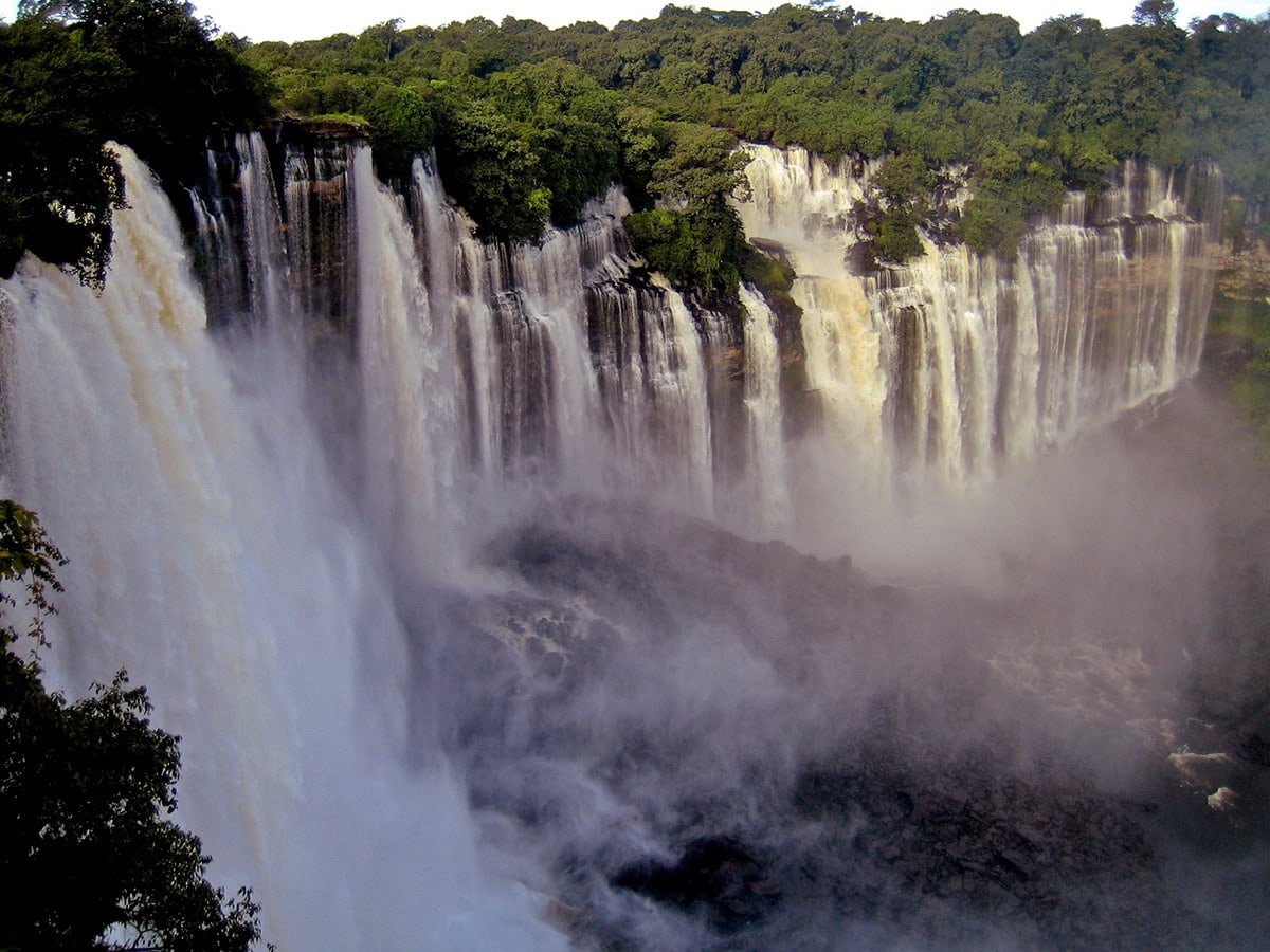
Description of Blue Nile Falls
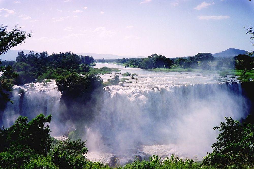
Tis Abay has formed on the edge of an ancient flow of basaltic lava. The Blue Nile here has flown for some 30 km after leaving Lake Tana. Already before the falls river has crossed numerous smaller waterfalls and rapids.
The Blue Nile in this area often divides into smaller streams. At the waterfalls, it also divides into four smaller streams, in the dry period of the year (January – March) forming four smaller falls but in the rainy period of the year (September – October) forming a roaring giant which was 400 m wide.
At high water above the falls rose a cloud of mist – thus it was named “smoking water”. The continuous mist created a small oasis of forest around the falls with numerous birds and monkeys.
The influence of the waterfall below the water level is much bigger – the approximately 37 – 45 m tall waterfall is an insurmountable barrier for fish. Thus Lake Tana has its own, unique species – 17 out of 28 species of fish in the lake are endemic.
History
Tis Abay is located in an ancient land and people have known this waterfall much longer than most of the other waterfalls in the world.
The first known description of the falls belongs to a Portuguese doctor and adventurer João Bermudes in 1565. Not too far below the falls Portuguese built also the oldest stone bridge in Ethiopia – Agam Dildi, built in 1626.
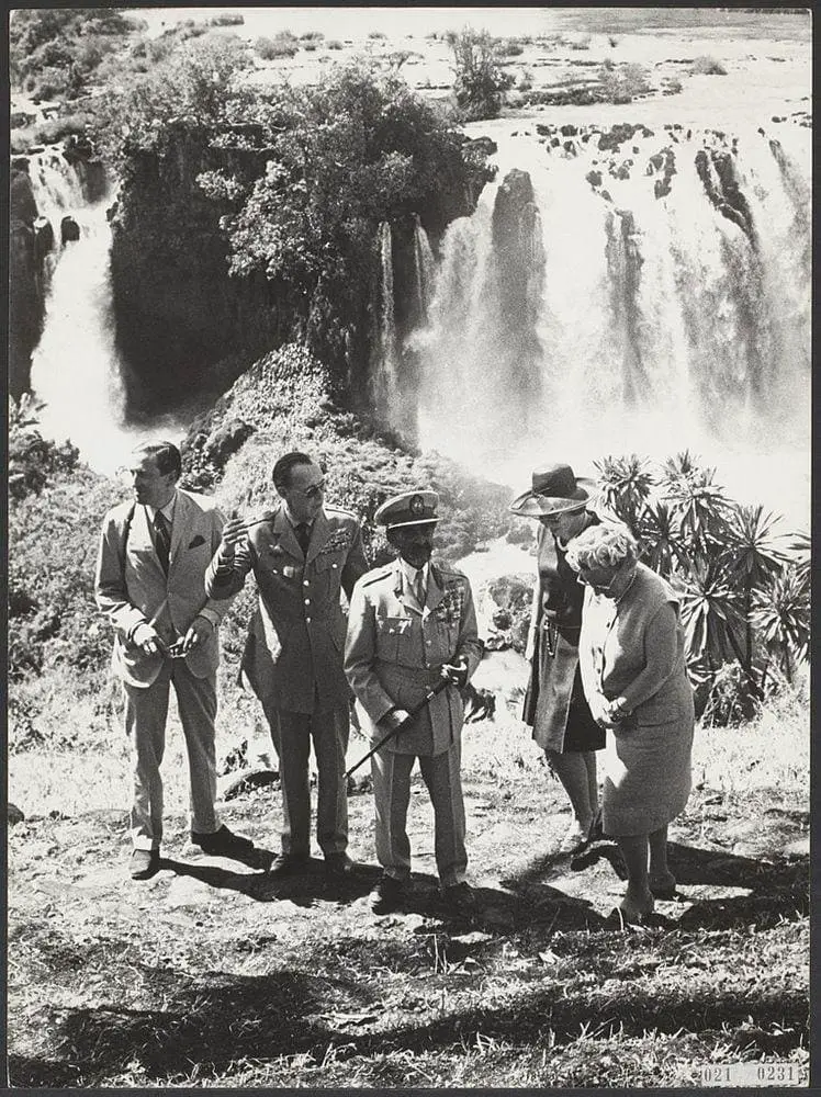
Many visitors came to these falls and in many descriptions, Tis Abay was presented as one of the greatest spectacles in the natural world.
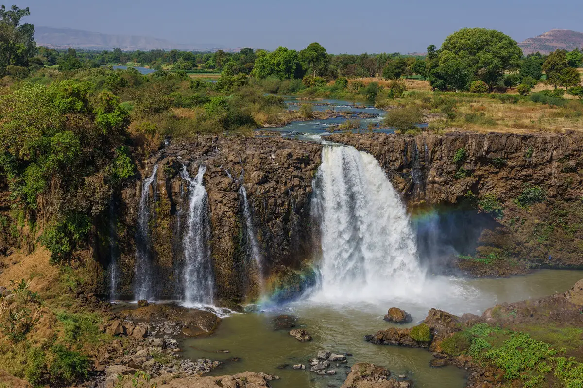
Since 2001 the situation has changed for the worse. Next to the falls is built a hydroelectric station (Tis Abay II) which during most of the year takes some 90% of the water away. Only during the rainy period of the year, the waterfall regains a part of its former beauty – but even then it has a lot less power than before.
Due to this nowadays the impressions of visitors to the falls are mixed. Some like the scenery but some are just disappointed – instead of the wide, roaring fall, there is falling a narrow stream or two streams.
Linked articles
Wonders of Ethiopia
Ethiopia is a very interesting country with a rich cultural and natural heritage. Highlights of Ethiopian heritage are its rock-cut churches, ancient stelae, and megaliths as well as places, where are found some of the oldest hominins and humans in the world.
Waterfalls
Some of the most fascinating and awe-inspiring natural monuments are waterfalls or locations where a river abruptly changes its elevation.
Wonders of Africa
Africa has many outstanding wonders and some of the most surprising ones are the heritage of Egyptian civilization, the vernacular architecture of the Sahel region, tropical ecosystems, and others.
Recommended books
The Alluring Temptress: Stories from Africa

Ronald Trigg, a retired U.S. diplomat, chronicles his encounters in Africa over a twenty-year period. His thirty-six stories, set in eighteen countries, offer vivid experience and a strong sense of place. From Timbuktu to Kilimanjaro, a pygmy campsite to wildlife-rich plains, the vast Sahara to urban townships, Trigg introduces fascinating cultures, memorable characters, and unforgettable landscapes. His South African memories present an eyewitness account of the dying days of apartheid. Each chapter of The Alluring Temptress is a stand-alone story guaranteed to whisk away the armchair traveler to a new and exotic locale.