
World 🢖 Antarctic and Sub-antarctic region 🢖 Australia 🢖 Heard Island and McDonald Islands
Volcanoes 🢔 Geological wonders 🢔 Categories of wonders
Wonder
McDonald Islands
 In short
Unusual changes transformed McDonald Islands in the time period from 2000 to 2001. Volcanic eruptions and (possibly) rise of the land increased the area of main McDonald Island from 1.13 km² to 2.45 km², rising the height of the tallest mountain from 186 to 230 m.
 46.8%
46.8%
GPS coordinates
Location, address
Alternate names
Height
Last eruption
Map of the site
If you see this after your page is loaded completely, leafletJS files are missing.
 In detail
Late discovery
McDonald Islands are very remote and little-known islands. They were first sighted exactly 157 years ago – on January 4, 1854 – from the ship "Samarang" and were named after captain William McDonald. The highest (then) hill on the island was named after the ship – Samarang Hill. This is a comparatively late discovery of new lands outside polar regions.
Back then this was a group of three small islands – 186 m high McDonald Island itself, 55 m high Flat Island a little north from it, and Meyer Rock – an impressive cliff rising from the sea 1.9 km to the north-west from McDonald Island. By the way – Meyer Rock is barely visible on Google Earth.
Although the island represented the summit of a volcano, it seemed to be a relatively peaceful place with many thousands of macaroni penguins (Eudyptes chrysolophus) breeding on it (see image).
People have not lived here and up to this day, the island has been visited a few times. One of the main reasons for rare visits is nearly impossible landing due to the permanently rough sea.
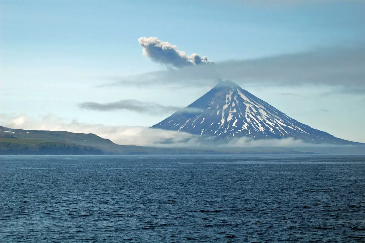
Sudden eruptions
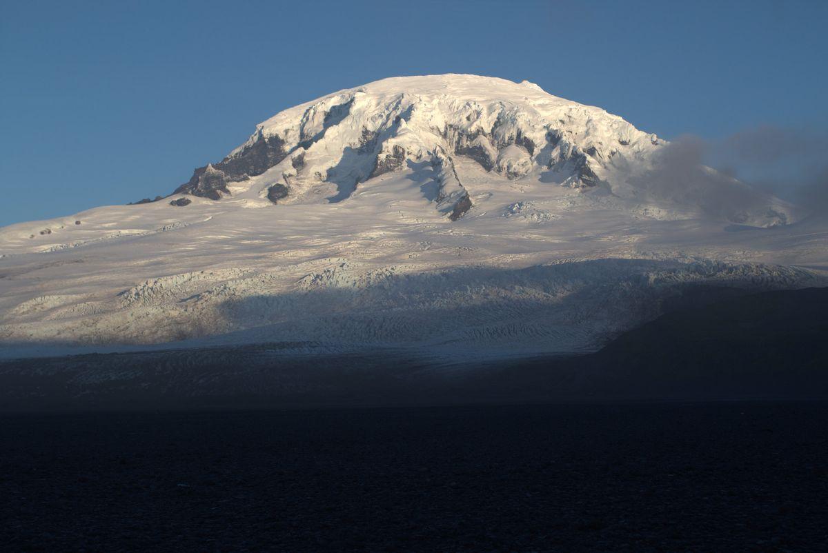
Volcano of McDonald Island was dormant for 75,000 years but in 1992 it suddenly became active. Several eruptions have taken place since then with volcanic plumes observed in December 1996 and January 1997, when floating pumice reached also Heard Island.
Especially significant changes took place in 2000 – 2001. The satellite image from November 2000 shows no major changes to the island’s geography. The image from 2001 though shows a completely different picture. Island has extended, mainly towards the north, joining with Flat Island. The highest point of the island has shifted to the north.
Last known eruption took place in 2005.
Island is built of layered phonolitic tuff and cut by phonolitic dikes – thus the geology here is completely different from the geology of 45 km distant Heard Island. During the eruption volcano exuded highly viscous, slowly flowing lava.
Google Earth image shows muddy water around the island – an active erosion process goes on and the newly extended island again is washed out. The western side of the island is exposed to rough winds and constant giant waves – it represents a giant, more than 200 m tall vertical cliff.
Return of life
During the eruptions there was destroyed almost all vegetation of the island. Nevertheless, satellite images show green patches of plants – they are quickly colonizing the new land.
Most likely eruptions disturbed also macaroni penguins. But the pumice fields may represent a good breeding site for them and it is possible that also king penguins (Aptenodytes patagonicus) will choose to breed here – or maybe they already are here.
References
- McDonald Island, image from the times when there were three separate islands, accessed 03.01.11.
- McDonald Island, rare image taken on the island in 1980, accessed 03.01.11.
Linked articles
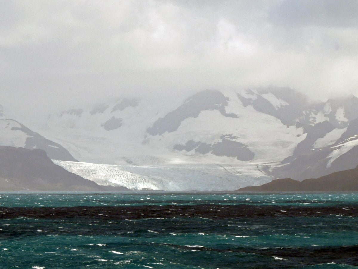
Wonders of Heard Island and McDonald Islands
Heard Island and McDonald Islands are some of the most remote islands in the world. Very few people have visited them but these islands represent truly remarkable sights.
Islands were included in UNESCO World Heritage List in 1997 and represent a unique site where can be observed unusually fast geomorphological processes and a unique, undisturbed ecosystem.
Volcanoes
This category includes the most unusual and interesting volcanoes of the world.
Over the last 10,000 years in some 1,500 places around the Earth mantle of Earth has emitted lava, ash, and gases through the crust of the planet. Each of these places is an active volcano. Some 50 – 70 volcanoes erupt every year and at any moment there are some 20 – 30 eruptions ongoing.
Wonders of Antarctica and Subantarctic islands
Antarctica and Sub-antarctic islands were the last part of Earth that was reached and explored by humans. The harsh climate prevents habitation of these lands except for Tristan da Cunha island which has much milder weather.
This is the largest wilderness region in the world with countless natural attractions that are not mentioned in any tourist guidebooks or Internet pages.
Recommended books
Heard and McDonald Islands, World Heritage Site

The Territory of Heard Island and McDonald Islands (HIMI) which includes the islands and the surrounding ocean to 12 nautical miles from shore was inscribed on the World Heritage List in 1997 for its outstanding universal natural values. The human history of Heard Island and the surrounding waters is relatively short, with the first confirmed sighting of the Island in 1853, and the first landing in 1854.
